AnalysisEnvironment and Climate ChangeFeaturesGlobal IssuesScience, Technology and InnovationSouth AmericaWorld
What Satellite Imagery Tells Us About the Amazon Rain Forest Fires
Scientists studying satellite image data from the fires in the Amazon rain forest said that most of the fires are burning on agricultural land where the forest had already been cleared.
Most of the fires were likely set by farmers preparing the land for next year’s planting, a common agricultural practice, said the scientists from the University of Maryland.
- By K.K. Rebecca Lai, Denise Lu and
- The New York Times
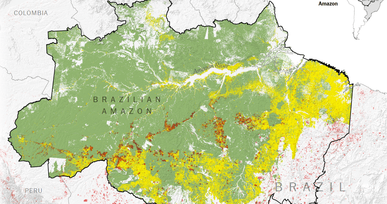 Satellite images like the one below show smoke plumes from fires emanating from agricultural areas…